Identifying real estate available for purchase is a simple process through the well-established commercial and industrial real estate markets that realtors, developers, lenders, insurers and attorneys participate in every day. Locating environmentally impaired and underutilized property that is available for purchase and redevelopment as part of a local or state redevelopment plan is another matter, yet it is the first critical step in the Brownfield process. State Brownfield programs that include formal designation of redevelopment areas, liability management, and financial incentives have greatly enhanced connections, leading to countless Brownfield success stories across the nation. Local governments actually hold title to a limited number of properties in need of redevelopment, therefore, privately owned properties represent the primary source of Brownfield opportunities.
State and local governments have been adding capabilities to their online GIS tools to help identify areas targeted for redevelopment, however, detailed information about individual properties on these databases appears to be rare, and updated information less so. A primary reason is likely the unintended consequences of labeling a property as under used or somehow impaired can inadvertently devalue property to the detriment of the owner of a property.
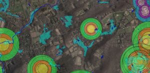
In New Jersey, NJDEP Bureau of GIS has released their Brownfield Inventory for New Jersey as a layer on their GeoWeb platform, an interactive mapping program that provides users internet-based access to environmental information. Through Geoweb, users can view valuable information such as acreage, cleanup status, and local infrastructure information for brownfields sites with redevelopment potential. The Inventory is currently populated with properties on the NJDEP Known Contaminated Sites List that meet certain use criteria and are located in the twelve municipalities participating in the NJDEP Community Collaborative Initiative. NJDEP plans to expand the inventory across the entire State.
This type of tool is also available in other states, ranging from general property lists to environmental GIS, and can be found on the Brownfield Coalition of the Northeast (BCONE) Resources Page. Some examples are:
- Maryland Land Restoration Program Determination Areas includes over 1,000 areas with potential redevelopment properties.
- Massachusetts tracks sites has interactive visual mapping tool by region, such as the CERO interactive map.
- Rhode Island includes “Development Sites” in their GIS tool, the RIDEM Environmental Resource Map.
The inventory concept is a great tool for identifying underutilized properties that represent opportunities for redevelopment. Overcoming the perception challenges of being on a list or map will improve the outcome for all.
